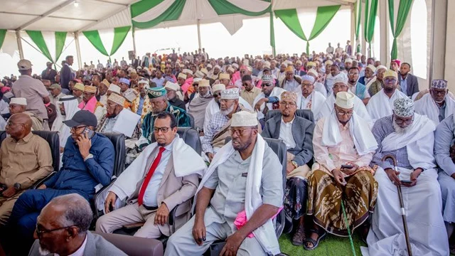

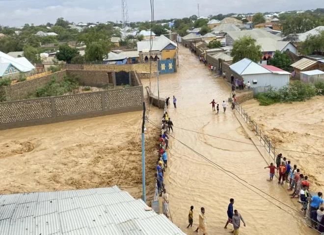
More than 12 hours of heavy rain in Baidoa, Somalia, left parts of the city under flash floods, underscoring the dangers facing the Greater Horn of Africa as a wetter-than-normal rainy season approaches.
The region has received a significant early warning. A climate outlook released in Kigali, Rwanda, on 18 August 2026 points to a heightened probability of above-average rainfall during the October–December 2026 rainy season.
- Advertisement -
Figure: Rainfall outlook for the October–December 2026 rainy season
The forecast was issued by the IGAD Climate Prediction and Applications Centre (ICPAC), in partnership with the National Meteorological and Hydrological Services of the Greater Horn of Africa and other institutions. It gives governments, humanitarian organisations, communities and development partners valuable time to prepare for potentially intense and torrential rains.
October to December is among the most consequential rainy seasons for the equatorial and southern parts of the Greater Horn of Africa. It supplies as much as 70 per cent of annual rainfall in some areas of Ethiopia, Kenya and Somalia, and up to 40 per cent in parts of Rwanda, Burundi, Tanzania and Uganda. How the season performs will affect farming, livestock, water supplies, food security, public health, infrastructure and trade across the region.
Southern Ethiopia, central and southern Somalia and north-eastern Kenya have a 90 per cent probability of receiving enhanced rainfall, according to the outlook. Seasonal totals could surpass 400 millimetres in parts of central and southern Somalia, central Kenya, the Lake Victoria Basin, Burundi, western Rwanda and western Tanzania.
Rainfall is forecast to start early or close to the usual time in Somalia, central and eastern Kenya, southern Ethiopia and most of Tanzania. Much of the region is also expected to experience above-average temperatures, especially eastern Kenya, Ethiopia, Eritrea, Djibouti and Somalia.
This is more than a routine weather bulletin. It is an early warning that should shape government contingency plans, humanitarian operations, local development decisions and household preparations now.
Understanding what is driving the expected rainfall
The outlook is linked to ocean-temperature changes that influence weather patterns around the world. El Niño has developed over the Pacific Ocean and is expected to strengthen through the rest of 2026. Meanwhile, the Indian Ocean Dipole is forecast to move into a positive phase.
When the two climate patterns occur at the same time, they often contribute to heavier rainfall in the eastern Greater Horn of Africa. ICPAC has cited 1997 and 2023 as useful historical reference years, since both brought above-normal rainfall to much of the region during the October–December season.
Those historical examples should inform preparedness, not be treated as a prediction that 1997 or 2023 will be repeated in 2026. The current forecast remains the principal basis for decisions.
A forecast for wetter-than-normal conditions also does not mean that every place will flood or that rain will fall without interruption for three months. Timing, intensity and location can differ sharply. One area may face prolonged rainfall, while another receives exceptionally heavy rain over only a few hours or days.
Preparedness must consequently account not just for the season’s total rainfall, but also for the speed at which rain falls, its location and the ability of rivers, soils, drainage networks and infrastructure to contain or carry the resulting water.
More rainfall can be both a beneficial and a threat
Following repeated droughts in parts of the Horn of Africa, heavier rainfall could bring welcome relief. It may restore dams, reservoirs, shallow wells and groundwater, revive pasture, improve livestock conditions, support crops and expand opportunities for rainwater harvesting.
But rain delivers those benefits only when it is managed safely. The same downpour that replenishes reservoirs and pasture can destroy homes, farmland and infrastructure if it falls with extreme force, lands on saturated ground or runs through degraded catchments and blocked drainage channels.
Intense rain can produce flash floods in drylands and urban areas, while prolonged rainfall can swell rivers and cause widespread riverine flooding. Floodwaters may kill or displace people and livestock, wash away crops, damage schools and health centres, contaminate water supplies and sever roads linking communities with markets and essential services.
Contaminated, stagnant water can raise the risk of cholera and other water-borne illnesses. Standing pools also provide breeding sites for mosquitoes, increasing the threat of malaria and other vector-borne diseases. Health and nutrition services may be disrupted at the very time vulnerable communities need them most.
Pastoralists could gain improved pasture and water while facing livestock disease, damaged roads, isolated grazing areas and hazardous river crossings. Farmers may receive enough rain to grow crops but still lose harvests through waterlogging, erosion or flooding where drainage and soil-conservation measures are insufficient.
Urban communities face a distinct set of hazards. Towns across the region are expanding rapidly, often without adequate drainage, while construction continues in floodplains and waterways. Poor solid-waste management and large informal settlements can leave entire neighbourhoods exposed. Heavy rain can overwhelm such areas quickly, causing deaths, displacement, property losses and economic disruption.
Somalia and neighboring areas require particular attention
Somalia and the adjoining lowlands of Ethiopia and Kenya need urgent, coordinated preparation. Shared rivers, cross-border roads, dryland catchments and mobile pastoral livelihoods connect the risks faced by communities on both sides of national borders.
Rainfall in the Ethiopian highlands can raise river levels and cause flooding downstream in Somalia, even if rainfall over the affected Somali communities is relatively moderate. Preparedness along the Juba and Shabelle rivers must therefore be accompanied by regular information-sharing between Ethiopia and Somalia on upstream rainfall, river levels and reservoir conditions.
Central and southern Somalia face both riverine flooding and flash floods. Residents along rivers, seasonal watercourses and low-lying land should receive frequent updates on changing conditions, evacuation routes, temporary shelters and access to essential services.
The Mandera Triangle, where Kenya, Ethiopia and Somalia meet, also demands close cross-border cooperation. Flash floods can destroy roads, cut off settlements and disrupt livestock movement, trade, markets and humanitarian access. The few bridges along the Jubba, Tana and Shabelle rivers that survived the 2023 floods remain vulnerable to being washed away. Border communities also commonly rely on grazing land, markets, water sources and services across national boundaries.
Climate hazards do not stop at political borders. Preparedness must reach beyond individual districts, counties and countries. Joint action is vital for monitoring threats, distributing warnings and safeguarding communities whose livelihoods depend on cross-border movement.
Turning the forecast into early action
The immediate task is to turn the regional outlook into clear, detailed local information. National meteorological and hydrological services should identify places most exposed to heavy rain, flash floods, river flooding and related threats. Disaster-management authorities, local governments and sector ministries should then convert those forecasts into practical scenarios.
They need to spell out what could happen, where, who or what may be affected and what actions are required. Seasonal outlooks support advance planning, but they cannot answer every operational question at local level. Governments, humanitarian organisations and communities should continue to track weekly, monthly and shorter-range forecasts, while monitoring river levels, soil moisture, reservoir conditions and observations from residents.
The second priority is to activate anticipatory-action plans and unlock funding before disaster strikes. Contingency budgets, emergency procurement systems, cash-transfer arrangements and agreements between governments and humanitarian partners should be in place before warning thresholds are crossed.
Waiting until homes have been destroyed, livelihoods lost and families displaced undermines the purpose of early warning. Once forecasts and river monitoring show that danger is rising, authorities and partners should be able to respond without delay.
Early steps could include forecast-based cash assistance for vulnerable households, the pre-positioning of food and essential goods, distribution of water-treatment supplies, preparation of temporary shelters, support for voluntary evacuation and relocation of equipment and vital stocks from flood-prone sites.
Medicines, mosquito nets, cholera-treatment supplies, livestock vaccines, boats and rescue equipment should be placed close to areas that could become inaccessible. Communities should also know where emergency supplies are stored and which organisation is responsible for assistance.
Reducing risk before the rains intensify
Local authorities should use the remaining preparation time to clear drains, culverts and waterways. Waste obstructing drainage channels must be removed and safely disposed of. Weak river embankments should be assessed and reinforced, and dams and other water-control structures should undergo urgent safety checks.
Water points, boreholes, latrines and waste-disposal areas need protection from contamination. Health authorities should strengthen disease surveillance, stock essential medicines, prepare mobile medical teams and identify alternative routes to communities that could be cut off.
Road agencies should identify flood-prone locations where transport is regularly disrupted and place machinery, fuel and repair materials nearby. Bridges, crossings and road segments threatened by erosion should be inspected before rainfall intensifies. Transporters and travellers should receive timely alerts about dangerous routes and available alternatives.
Agriculture authorities should guide farmers on planting schedules, appropriate crop varieties, soil conservation and field drainage. In flood-prone areas, farmers may require assistance to safeguard seed, equipment, stored crops and livestock feed.
Livestock agencies should expand surveillance for diseases associated with wet conditions, conduct vaccinations where appropriate and advise pastoralists on safer grazing areas and movement routes. Fodder should be stored in places protected from floodwater.
Such interventions must be planned carefully. Reinforcing an embankment in one place must not divert floodwater towards another community. Drain clearance should be paired with effective waste management. Water-harvesting facilities must be built and maintained safely to avoid dam failures, erosion and the formation of disease-breeding sites.
Evacuation plans should account for children, older people, pregnant women, persons with disabilities and households that lack transport. Temporary shelters need sufficient water, sanitation, healthcare, security, privacy and protection.
Anticipatory action is not merely a race to respond. It means taking appropriate measures early, preserving human dignity and ensuring that efforts to reduce one danger do not create another.
Climate information must reach the people who need it most
A climate forecast has little value for public protection if it remains in the GHACOF hall, technical reports, conferences or government offices. It must reach the people deciding whether to plant, move livestock, reinforce homes, protect businesses, alter travel plans or evacuate to higher ground when necessary.
Warnings should use several trusted channels, including local radio, community meetings, extension and health workers, religious leaders, schools, disaster-management committees, market associations, mobile-phone alerts, social media and interactive voice services.
Information should be delivered in local languages and accessible formats, then repeated and updated regularly. One announcement at the start of the season is insufficient, particularly when conditions can change quickly.
Messages must explain more than the prospect of wetter-than-normal weather. Residents need to understand the likely local effects, the areas most exposed, the period of greatest concern, the steps to take, places to avoid and where help will be available.
Terms such as El Niño and the Indian Ocean Dipole may be important in scientific discussions, but communities need practical direction. A warning should tell farmers whether to improve field drainage, pastoralists whether a river crossing is unsafe, traders whether a major road could close and families whether they should prepare to leave.
Communication must work in both directions. Reports from communities about rising rivers, damaged embankments, blocked drains, livestock disease, dangerous roads and population movements should feed into official monitoring and decisions.
Women, farmers, pastoralists, fishers, transporters, displaced people and persons with disabilities may experience the same hazard in different ways. Their knowledge and involvement can make preparedness measures more accurate, workable and trusted.
The media also carries a significant public-safety responsibility. Journalists should receive regular briefings from meteorological, hydrological, health and disaster-management authorities. Sensational coverage can provoke unnecessary fear, while vague or contradictory reporting can encourage complacency. Forecasts should be reported accurately alongside clear, verified public guidance.
Four priorities for the preparedness period
First, governments must localise the outlook and identify its likely consequences. Regional information should be combined with national and local forecasts, river monitoring, flood-risk maps, infrastructure data and community knowledge. Every district, county, municipality and cross-border cluster should identify its main danger zones and priority measures.
Second, governments and partners should release early funding and implement practical safeguards before damage occurs. Clearing drains, protecting water sources, reinforcing disease surveillance, positioning emergency supplies, repairing crucial access routes and supporting safe water harvesting can all help, even if the worst rainfall scenario does not materialise.
Third, authorities must build reliable last-mile warning systems. Alerts should reach communities in languages and formats they understand and include clear instructions. Radio and mobile technology should be combined with community engagement, especially in remote areas and among mobile populations.
Fourth, countries must improve coordination across sectors and borders. Meteorological and hydrological services, disaster authorities, health agencies, agriculture and livestock departments, water institutions, road agencies, humanitarian organisations, local administrations and the media should hold regular operational briefings. Upstream and downstream information must move quickly, particularly across the Juba and Shabelle basins and other shared catchments.
The value of a forecast lies in the losses it prevents
The October–December 2026 outlook has given the region one of its most valuable resources: time. Governments and communities do not need to wait for rivers to burst their banks, roads to vanish or families to be displaced. The scientific information is available early enough to guide plans, release funding and protect those facing the greatest risks.
ICPAC, as the regional climate centre, is expected to continue issuing regional updates, while National Meteorological and Hydrological Services provide detailed country forecasts and public advisories. Stakeholders must follow those updates because the seasonal outlook will evolve and local hazards can develop rapidly.
Preparedness should be continuous rather than a one-off reaction to a seasonal bulletin. The outlook is strong enough to warrant immediate action, yet uncertain enough to demand regular monitoring. If the region moves early, heavier rainfall could replenish water supplies, support agriculture and restore pastoral livelihoods while reducing the threat of destructive floods.
If the warning is discussed but not converted into action, communities may once again suffer losses that timely climate information could have helped avert.
The forecast’s success will not be judged solely by the precision of its maps. It will be judged by how quickly the information reaches exposed communities, the decisions it influences, the early measures it activates and, above all, the lives and livelihoods it saves.
___________________________
Hussein and Abdiweli are climate change adaptation and DRM Experts who have been involved in translating Regional Climate Outlooks into practical actions in the Horn and Southern Africa Regions for many Years, supporting different partners in Africa.