

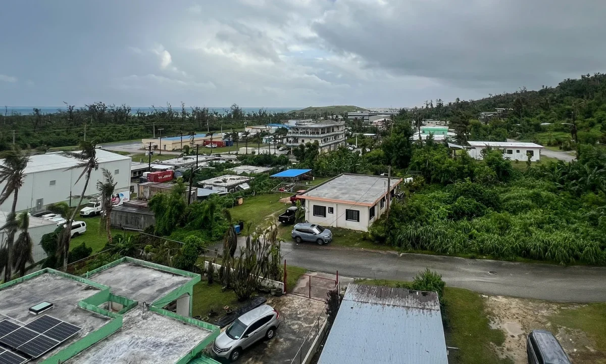
With the storm still hours away, Guam and the Northern Mariana Islands were already being pummeled by fierce winds and driving rain — a tense opening act before a forecast “super typhoon” expected to slam the US Pacific territories with the kind of force usually reserved for a category-5 hurricane.
According to the Joint Typhoon Warning Center, Super Typhoon Bavi was expected to barrel westward over the area early tomorrow, packing maximum sustained winds of up to 280 km/h and gusts reaching 333km/h.
The National Weather Service (NWS) described the system as “very dangerous,” cautioning residents about the risk of “catastrophic wind damage” near the eye, along with storm surges and “hazardous” surf.
By this afternoon, the threat had already emptied much of the streets. Across Guam and the Northern Marianas — together home to roughly 210,000 people — only a handful of vehicles moved through the rain, while police patrols circulated, warning people to be careful.
“I cannot afford to lose so many days. It hurts,” she said.
The National Weather Service called the typhoon ‘very dangerous’
For some, the approaching storm brought fear — especially for children trying to make sense of the howling weather. Call centre employee Arabella Paulino, 48, said: “My girls were saying to me it’s scary. But it will be okay.”
She said she was leaning on the strength of her home’s construction as she prepared for the worst. “My house is concrete, so the worst that can happen is a window could blow in,” she said.
Tourists were also forced to adjust. Japanese visitor Miku Sakurai, 25, had planned to fly back to Tokyo with friends, but their flight was cancelled.
“We will stay in the hotel when the storm comes. I am scared,” the office worker said.
Even as most residents and visitors hunkered down, a small group chose the opposite — chasing the swell rather than fleeing it. Around a dozen surfers took advantage of the rough conditions at a beach in Guam’s Talofofo Bay.
“There’s quite a lot of debris in the water but it’s a lot of fun,” said one of them.
This afternoon, there were few cars on the roads in Guam or the Northern Marianas
‘Praying’
The Northern Marianas in the western Pacific has a population of around 40,000, and nearby Guam, a separate US territory, although both are part of the Marianas archipelago, about 170,000.
Residents have endured powerful storms before, and memories remain fresh. Super Typhoon Sinlaku, which struck the region in mid-April, cut electricity for tens of thousands of people, toppled trees, flipped cars and tore metal roofs from buildings.
In 2023, another huge typhoon — Mawar, the biggest in decades — also left widespread devastation.
The NWS said Bavi was expected to pass closest to the small island of Rota, the southernmost part of the Northern Marianas, at around 8:00am on Monday (11pm Irish time today).
The agency warned that if Bavi’s track brings it near or directly over Rota — home to about 1,500 people — most of the island “will be uninhabitable for weeks, perhaps longer. Many non-concrete, non-reinforced homes will be destroyed, with total roof failure and wall collapse,” it said.
It added that the destruction would likely be sweeping: “Nearly all trees will be snapped or uprooted and power poles downed. Fallen trees and power poles will isolate residential areas. Power outages will last for weeks to possibly months.”
Local officials urged unity and urgent preparation as the storm neared. “By working together and taking the necessary precautions, we can help protect our families, neighbors and community. We pray for the safety of our people,” Rota mayor Aubry Hocog said.
El Nino
Beyond the immediate danger, forecasters and climate agencies have pointed to conditions that can fuel stronger storms. The European Union’s Copernicus Marine Service said the world’s oceans logged their hottest June on record and could reach new highs in the months ahead.
Warmer seas can supercharge tropical systems, helping storms intensify while also loading the atmosphere with moisture that can fall in punishing bursts of rain.
The World Meteorological Organization warned on Friday that El Nino — which usually develops every two to seven years and lasts nine to 12 months — has already started in the tropical Pacific and is likely to be strong.
The natural climate phenomenon raises surface temperatures in the central and eastern equatorial Pacific Ocean, triggering global shifts in winds, pressure and rainfall patterns.